
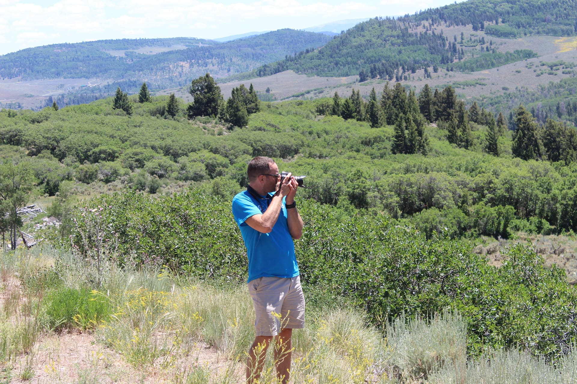
In 2018 I took part in G-Camp, a 17-day geological field camp hosted by Texas A&M and sponsored by Saudi Aramco. During this time I was able to get first-hand experience of the geology of Texas, New Mexico, and Colorado. Two of my earth science teacher friends (and amazing teachers) also just happened to apply and got in. We were able to collaborate with an Ultimate Beastmaster, a mountain goat, and so many other wonderful educators. Those western states were not prepared for what was about to hit them!
Google Earth Virtual G-Camp Tour
If you are accessing my tour from a phone you need the Google Earth App installed. No software is needed if you access it from a computer.
Daily Star article about my trip
Here you can find a brief overview of some of the things we experienced during this epic adventure. I’ve got hundreds more photos and dozens of stories if you want to hear more.
First Few Days on the Road


After something like 700 miles in the bus traveling across Texas and making quick stops to see some Pleistocene sand dunes and the Canadian River we entered New Mexico. Hour after hour had passed of nothing but flat terrain with dead vegetation. Then in the distance you could make out the silhouette of some volcanoes! One of our destinations would be Capulin, cinder cone volcano that last erupted over 60,000 years ago. I use a model of this volcano in a lab that I do to help students learn contour lines so I was excited to be able to be here. It was also exciting to be on an actual volcano! We were able to hike around the rim, go into the crater, and check out the geology before we hit the road again.
Later that day we would make a stop to check out a rock outcrop. Within this outcrop is evidence of an asteroid impact that occurred 65 million years ago that helped lead to the demise of the dinosaurs. There is a thin layer of iridium and shocked quartz found around the world known as the K/PG boundary. This outcrop is one of the best places in the world to see it and we got up close and personal to it!
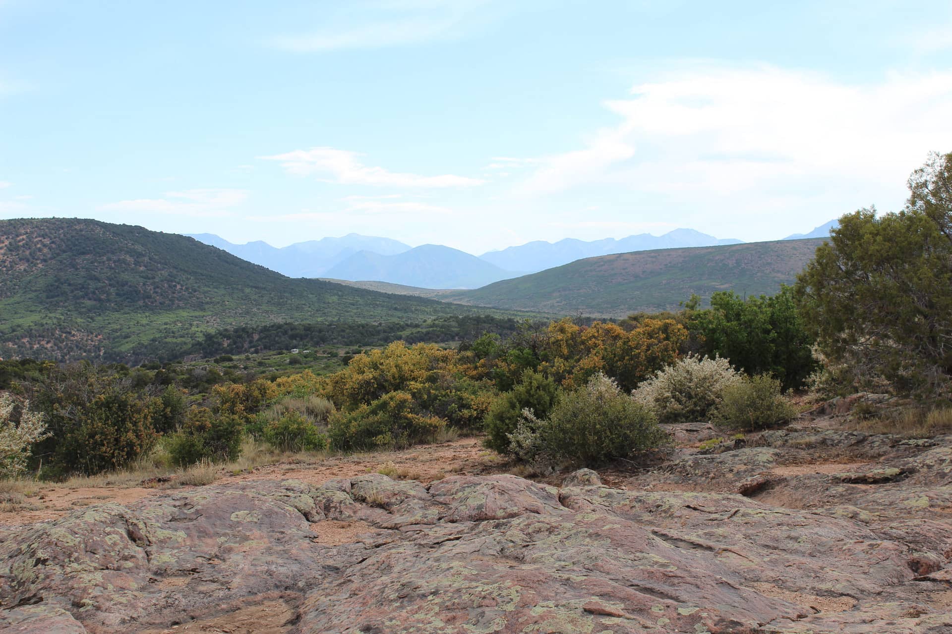
Next we would make a stop to see the Devil’s Staircase, a part of the Spanish Peaks. What we were looking at is a rhyolite dike that was left exposed as the surrounding sedimentary bedrock weathered away. Along the dike you could see some quartzite that formed through contact metamorphism as the magma intruded through the sedimentary rock. Unfortunately shifting winds and a rapidly approaching wildfire forced us to evacuate from the valley. As the bus pulled away the skies grew darker and darker as it filled with smoke.
Teepee Buttes


")


During the late Cretaceous Period (about 75 million years ago), Colorado would have been at the bottom of a sea. At the bottom of the sea the crust fractured due to tectonic processes and methane seeped out. This methane was mineral rich which provided a habitat for a diverse range or organisms. As these organisms died they piled up around the seep. If we go forward in time about 75 million years we will see the Teepee Buttes. They are cone shaped hills consisting of fossil-rich limestone surrounded by shale (Pierre shale). At the center of each formation is a vuggy (full of holes) central pipe consisting of limestone. Fossils found include part of an ammonoid, a fragment of an orthocone, and countless clams (Nymphalucina occidentalis). Many of the clams were given away to area students when I taught a lesson on the geology of the Catskills to students at the Michael Kudish Natural History Preserve.
Black Canyon of the Gunnison

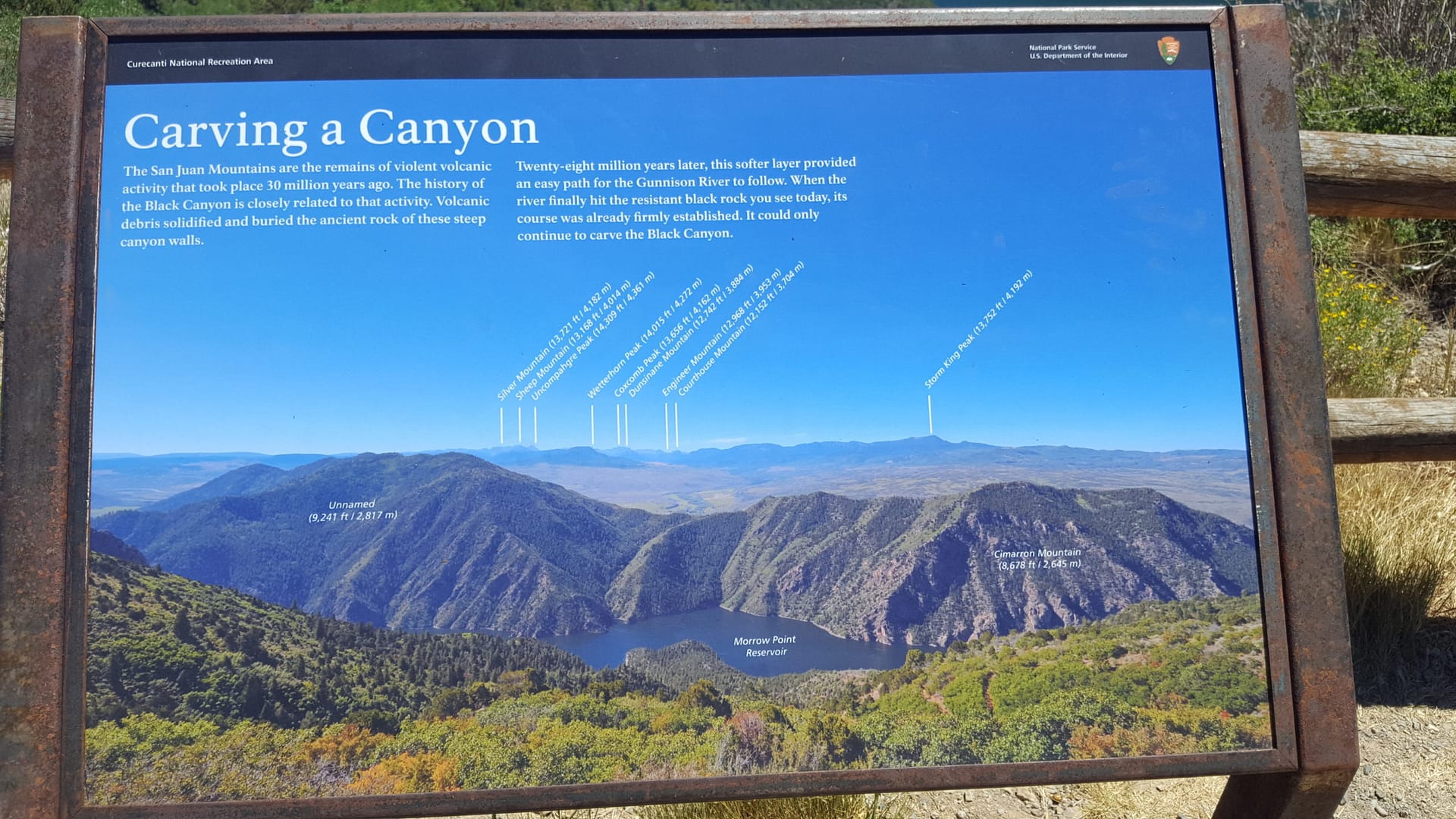

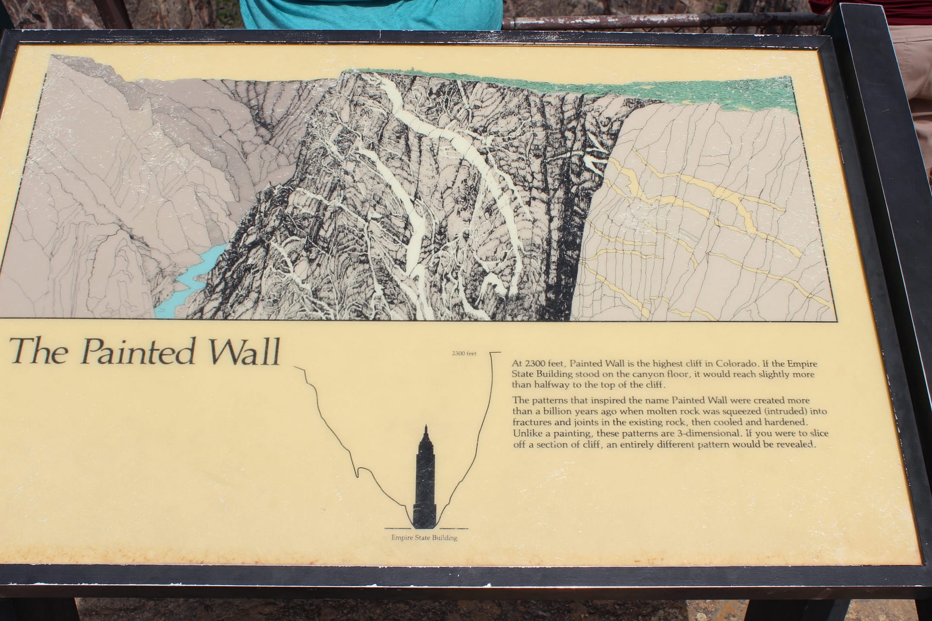

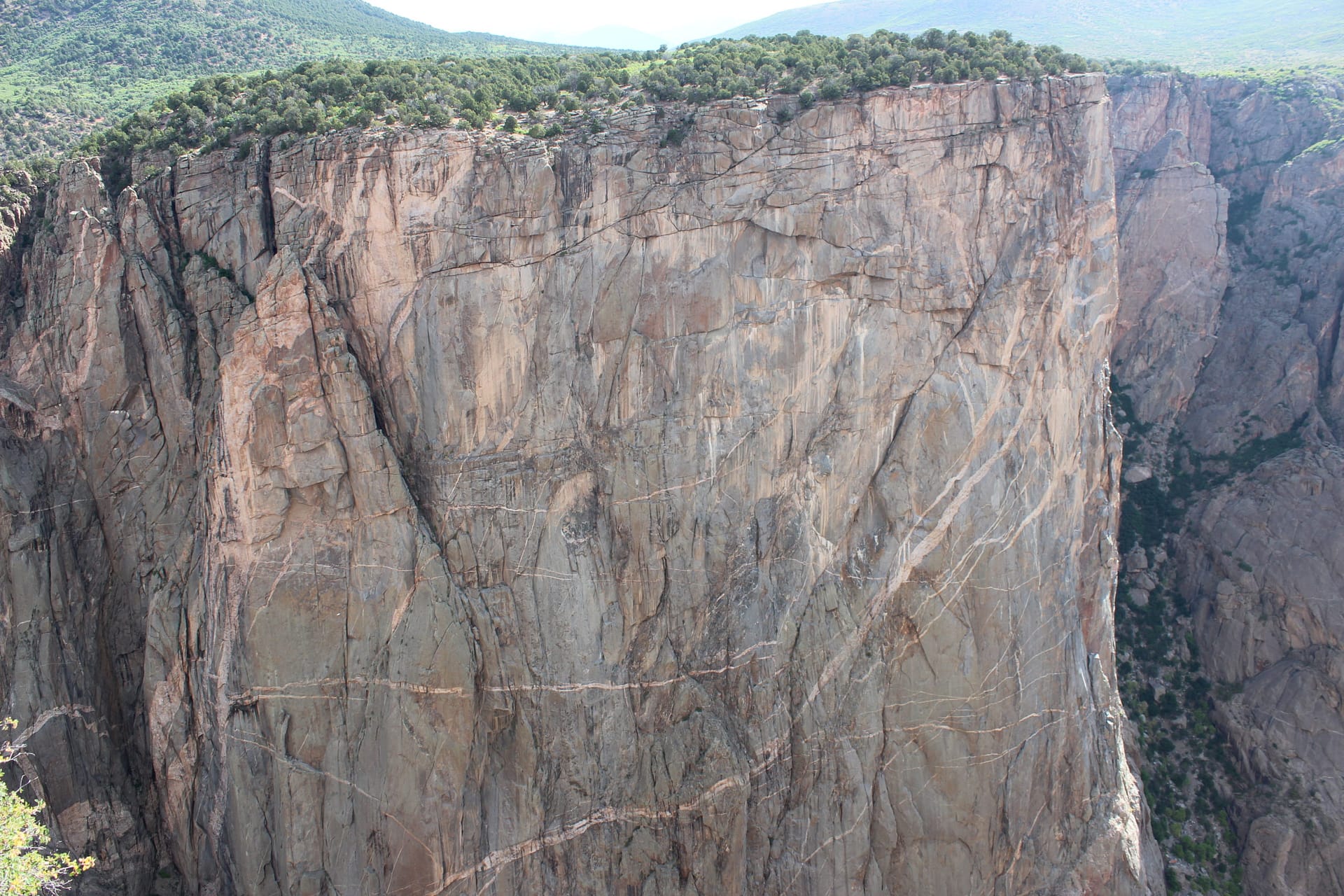
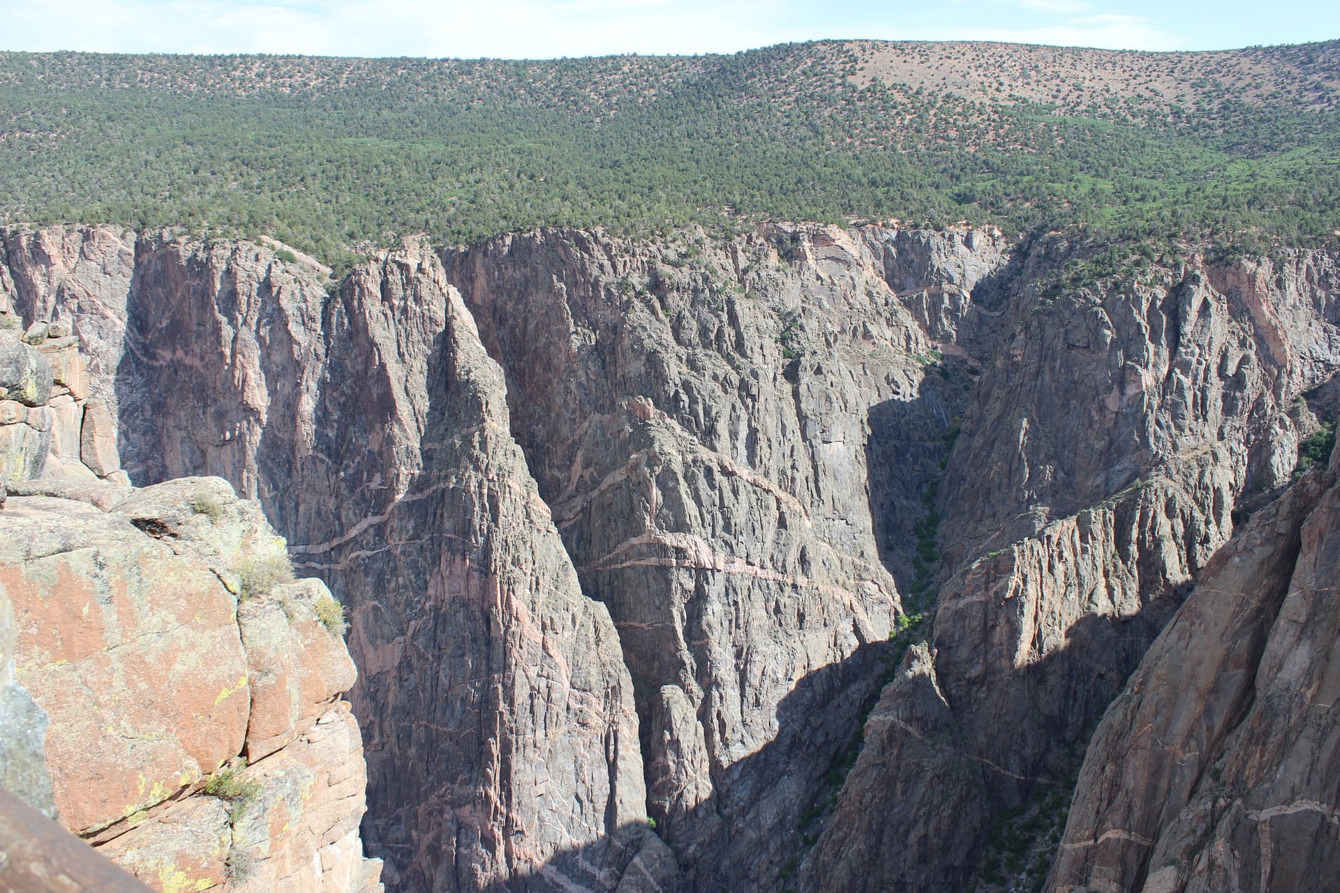
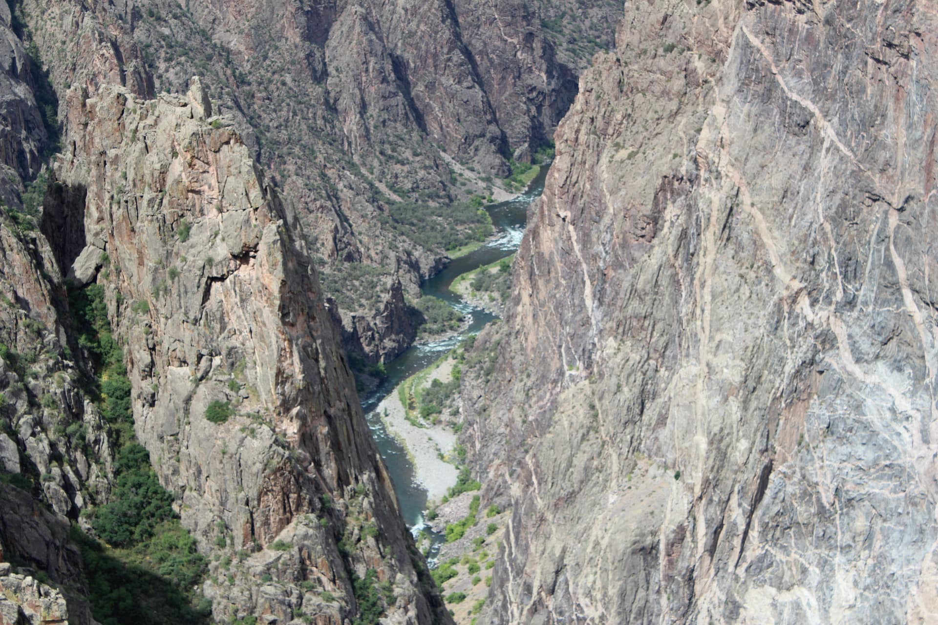
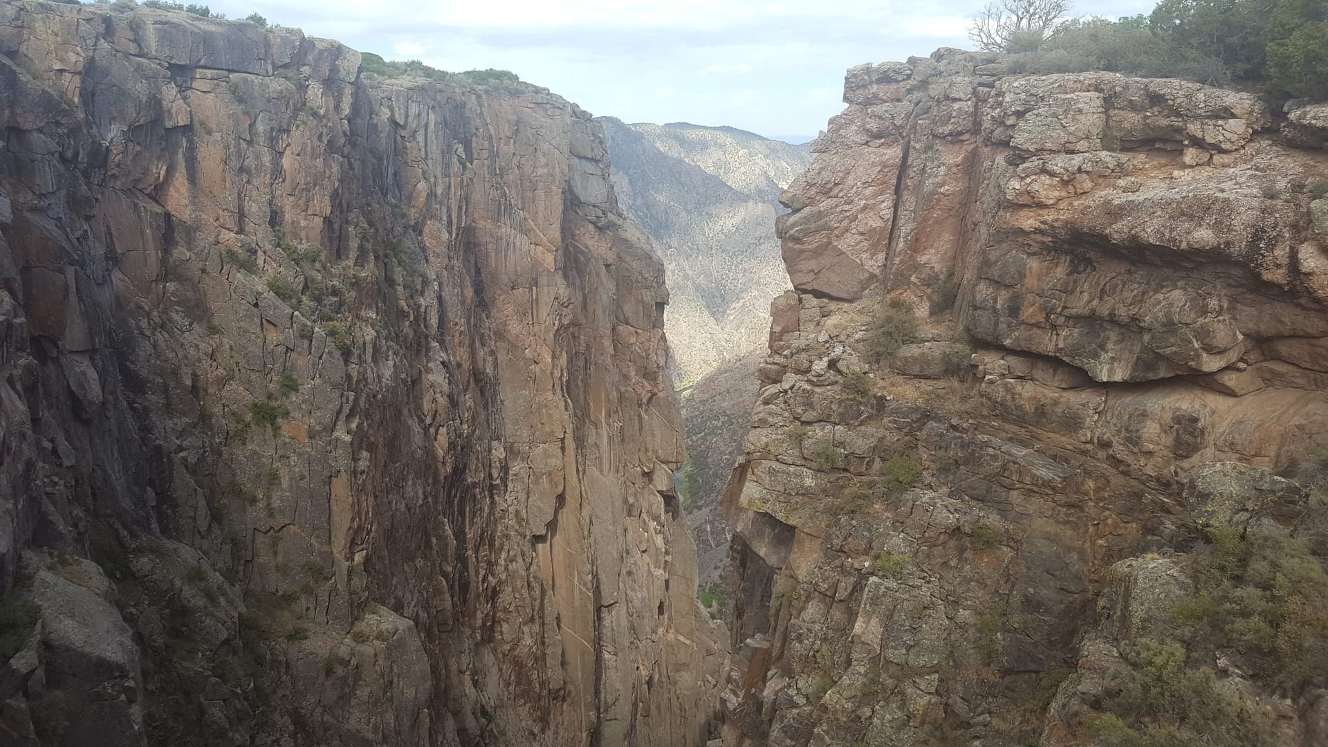

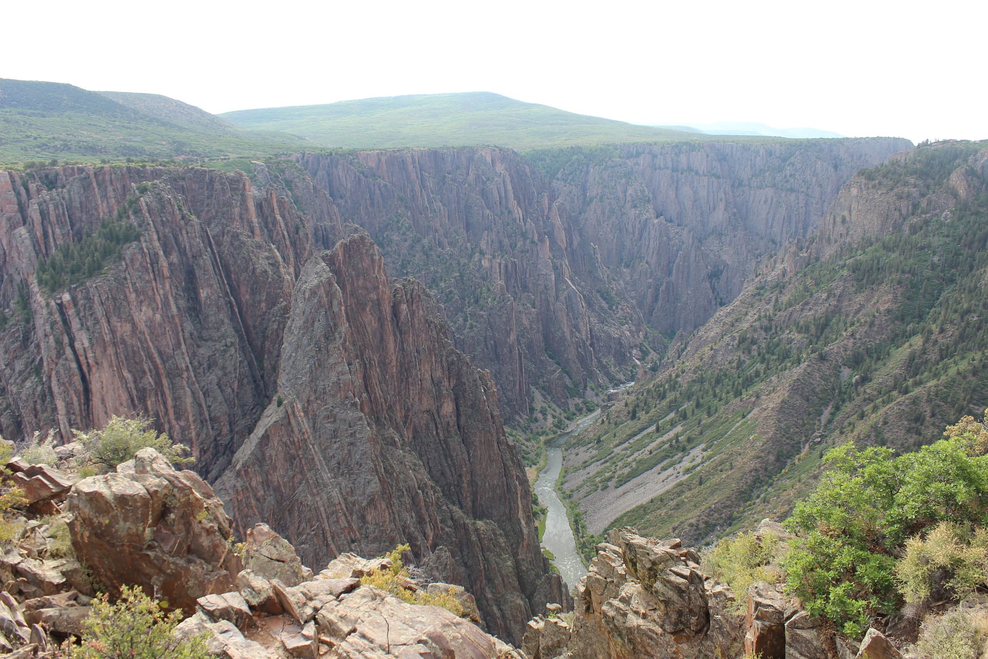

A story that began in the Precambrian that continues today. The Black Canyon of the Gunnison is unlike anything that I have witnessed on the east coast. One day we spent visiting the North Side of the canyon and it was beautiful but nothing prepared me for what I would witness at the South Side. At its highest point, the canyon drops about 2000 feet straight down into the river below. We could see a vertical wall composed of gneiss that had pegmatite intrusions cutting across it. All of this formed about 1.7 billion years ago. On top of that was sedimentary rock that was only about 100 million years old. What happened during that billion year gap? That is what we call an unconformity; a gap in the rock record. The Gunnison River drops an average of 34 ft/mi through the park while the Colorado River drops an average of only 7.5 ft/mi through the Grand Canyon. I found myself staring at the Painted Wall for quite some time, following every little contour. Pictures just don’t do it justice. Plan a trip to go here someday. You will not be disappointed!
❤ Ouray ❤


Ouray, Colorado was our base camp for about a week. From the moment we started to enter the valley I knew that I was in love! Ouray is nestled in the Rockies and is known as the “Switzerland of America”. Our hotel was situated right next to a walking path along the Uncompahgre River. It was about a half mile walk along this path into town and we made this walk countless times. The day after we arrived was the 4th of July and the town was full of excitement. Several of us brave souls decided to get up early to run their 10k. We spent the previous night in the hot tub and we were not used to being up at elevation but we went for it anyways. It was such a beautiful course and we all had so much fun. Next was their legendary 4th of July parade. There was a wet side of the road and a dry side of the road. Of course most of us chose the wet side, and they did not disappoint! While in Ouray we also dabbled in fluvial geomorphology, we did a stream study, we hiked the perimeter trail around the town, played football across the river, soaked in the hot springs, participated in karaoke, cored some trees, took a ride on the million-dollar highway, and so much more! The million-dollar halfway was closed shortly after we left Ouray because of rockslides caused by heavy rain. It also turns out that the grumpiness of Mr. Grumpy pants is exaggerated.
While in Colorado I may have upset some of my coworkers by posting a list of job openings in the state. For that, I apologize!
Don’t worry, the adventure continues on the next page!
The views and information presented are the participant’s own and do not represent those of G-Camp, Texas A&M, or Saudi Aramco.