The Adventures of a Science Teacher

Tag: Colca Canyon

Will I Make It Out of the Canyon?

Day two in the Canyon saw a much later start than the previous day. As mentioned in the previous post, there are several reasons why I was glad that I chose to do this hike in three days instead of two days. It was nice to be able to relax within the cabin and we enjoyed some really good food our first day in the cabin. The second reason I am glad that we did the three day hike is that we got to walk through two towns that the other hikers did not get to see and we were able to learn more history about the people in the canyon. After a fairly short walk we arrived in Cosñirhua. Primary students in San de Chuccho would have to walk to Cosñirhua to attend school. There are very few kids in this age group though as the school would only have eight students and one teacher.

Cosñirhua. You can see the school to the left of the image with the courtyard covered with the green tarp. It didn’t take us long to walk through this town.

There is a gold mine on the opposite side of this mountain and they have invested in these towns. They are the reasons they have roads and they are building an aqueduct to help provide water to the people that live here. There is only one secondary school in this valley and while there used to be a school bus to take students to this town (towards the top of the valley) it is broken so students have to walk up to 90 minutes to get to school. Not sure what is happening with the bus but the gold mining company bought it. Hopefully they plan on fixing it.

Aqueduct cut through the mountain. Earthquakes will often damage infrastructure like this.

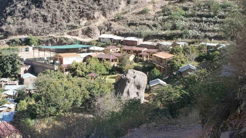
The next town we would walk through would be Malata. This primary school has 14 students currently attending it. We walked past a tiny little clinic that is the only clinic if people get sick in any of these towns. Down the road a little further is a private clinic (much nicer) that is for the gold miners. Apparently in emergencies they do help out the people that live there.

Entering Malata

After passing through Malata we would drop back down to the bottom of the valley to cross the Colca River again. Once we crossed the river we would climb back up a little bit and enter Sangalle, an oasis at the bottom of this valley. There are no roads to this town and the only way to get in or out is by walking. Mules carry goods in and out of the bottom of this valley.

Sangalle. The trail out of the canyon can be seen on the left.

The third reason that I was glad that I did the three day hike is that I got into Sangalle around noon. This meant I got to enjoy the swimming pool during the heat of the day. Since we were near the bottom of the canyon, the sun set behind the canyon walls around 3:30 p.m. and temperatures dropped quickly. It is winter in Peru. People that did the two day hike arrived at Sangalle between 4 p.m. and 7 p.m. and they could not enjoy the pool as much as we did. Some of them did jump in but they found it really cold.

The pool in Sangalle

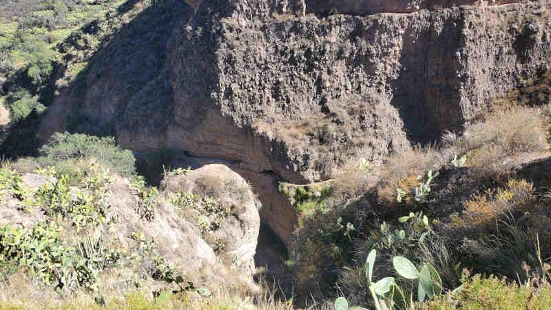
It was an early night as the next morning would be tough. We would be hitting the trail by 4:4o a.m. to hike to the top of the canyon. Our goal was to reach the top before the sun rose and then we would get to have breakfast. The climb was steep but we made good time. We hiked over a mile in the first hour. Things started to slow a little at that point though. What made it tough was how dry it is. You don’t realize how much dust is kicked up hiking in this area until you are hiking by headlamp. As the second hour ticked by fatigue was starting to set in. It looked like the top was approaching but I know how misleading false summits can be. It turns out that this wasn’t a false summit and I was almost to the top. With about 15 minutes of hiking remaining the sun started to rise. When I reached the top there was this tremendous sense of accomplishment.

The hike out of the canyon. The last half of a mile to town was flat. That means we climbed about 3500 feet in just under 3 miles.
I did not drink any chicha prior to starting this hike. This is what the trail was like!

After reaching the top we walked another half a mile to town, had breakfast and left. Not too long after leaving we stopped at some natural hot springs to soak our tired/sore legs and it did feel good. On our way back to Arequipa we stopped at a viewpoint that was over 16,000 feet high and saw several volcanoes. We stopped once more so people could use the restrooms but I was fixated on the volcanoes as well as the hoodoos that I saw. Eventually we made it back to Arequipa and I prepared to move on to my next destination early the next morning.

Smoking volcano!
Peruvian hoodoos!

A Hike? To the Bottom of the Second Deepest Canyon on Earth? Sure!

These are the things that I get myself into when I don’t get much sleep. Then again, I probably would have still done it anyways! I do want to disclose that we didn’t start from the canyon’s highest point nor did we go into the deepest part of the canyon but it was still about 4,000 feet of difference from the highest point to the lowest point. This adventure would start from Peru’s 2nd most populated city, Arequipa. This city is beautiful with buildings constructed of volcanic rock. It is also surrounded by volcanoes!

You can see some snow-capped volcanoes in the background

For my hike of the Colca Canyon I had the choice of doing it in two days or three days. I’d previously spent the past two weeks in cities and I was looking for some relaxation so I opted for the three day hike. Apparently this is not very common and there was only one other person. Everyone else does it in two days and we were both glad we chose three days for reasons which will be explained later.

Andean Condors

Like so many of my adventures, we got an early start. I had to be ready to go by 3 a.m. After two hours of driving we stopped at an overlook where Andean Condors like to ride the thermals. These condors are the heaviest flying birds and can have wingspans that reach 11 feet! They can go months between meals and can go hours circling the skies without flapping their wings. The Andean condor was considered holy by the Incas.

A juvenile condor dropped by for a visit

After a little more driving we arrived to the trailhead for the start of our hike. We were on the southern rim of the canyon which meant that the walls of the canyon were facing the north. This is weird to say but during the day the sun is in the northern part of the sky. While it is indeed winter, we are at a fairly low latitude so the sunlight would be fairly strong. When paired with the high altitude, solar intensity would affect me much more than the elevation would.

A map showing average solar intensity for July. The red indicates high intensity. The red line was our the approximate path we took over the three days.
You can see three towns we would walk through in this image. We would spend the night at the town on the far right. Beneath the towns are terraces created by the Incas and pre-Incan cultures to reduce erosion and for agriculture.
Looking down on Sangalle, an oasis at the bottom of the canyon. We would come in from the right, spend the second night here, and hike out towards the left.

After a short hike along the rim we began our downward journey to the bottom. The sides were steep and the trails were just several miles worth of switchbacks. One misstep and you would find yourself falling uncontrollably towards the bottom of the canyon. This wasn’t too much of a concern at first but after hours of being out in the sun and feeling the effects of heat exhaustion I had to be extra careful with where I stepped.

The trail before the switchbacks began. The slope it crosses is incredibly steep!

As we descended, sheer walls of columnar basalt towered over us. It was intimidating and unnerving to know that an earthquake could occur at any time that could bring these walls down on top of us and we would have nowhere to go. Fortunately there were no earthquakes and I could admire all the geologic wonders that were there.

Columnar basalt

Eventually we did make it to the bottom of the canyon. After crossing a bridge across the Colca River it was time to start ascending up the other side a little bit. By this time the heat was really getting to me and I struggled more than I should have. It would not be too much longer until we got to the small town, San Juan de Chuccho, where we would have a lunch (made over a fire) and spend the night. Avocados are grown in this valley and it was served with every meal. The food we had while staying here was excellent and the woman was very nice. It is impressive because there is no road nor is there any electricity. After lunch, the people hiking the canyon kept going another 3 miles while I got to relax in the canyon and take in the views.

In the foreground you can see the building I spent the night in. In the background you can see the trail zig-zagging down the slope.

It took me a few hours of hydrating and resting to start to feel like myself again. Agnes would have been disappointed as I was not able to finish my lunch. By dinner I had my appetite back and was back to finishing my meals. Stay tuned for part two of the Colca Canyon trek!

Powered by WordPress & Theme by Anders Norén